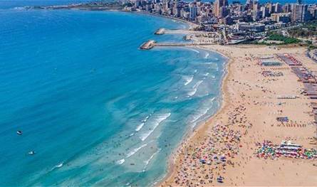
The Department of Estimates at the Meeting Authority of the General Directorate of Civil Aviation expected that the weather will be partially cloudy with fog on the highlands without a significant modification of temperatures on the coast while it decreases slightly over the mountains and at home, as the wind is activated, so we warn against the rise of the sea wave.
The following newsletter said:-The general case: a moderate summer weather with temperatures within its seasonal rates that control Lebanon and the eastern basin of the Mediterranean during the coming days.-The expected weather in Lebanon:
Tuesday: Low clouds to partly cloudy with fog on the medium heights, with it the vision is worse in the evening. The temperatures decrease over the mountains while it rises slightly inside and on the coast where it becomes higher than its seasonal rates, as the wind is activated, so we warn against the rise of the sea wave.
Wednesday: Partially cloudy with fog on the highlands without a significant temperature modification on the coast while decreasing slightly over the mountains and inside, as the wind is activated, so we warn of the height of the sea wave.
Thursday: Partly cloudy to little clouds without reminiscent temperatures on the coast, while it rises slightly over the mountains and inside, and local fog is formed on the highlands in the evening.
Friday: Little clouds, with a slight rise in temperature and local fog on the highlands.
The post Activated winds and warning of the height of the wave .. How will the weather be in the coming days? appeared first on 961 tobay Lebanon today.


