

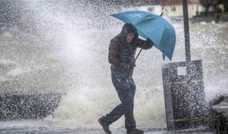
Relative autumn ritual controls Lebanon and the eastern basin of the Mediterranean with temperatures higher than their seasonal rates, as temperatures decline from tomorrow as a result of the flow of moderate air masses, knowing that the region will be affected starting from Tuesday evening by average average air depression, its center northwest of Turkey leads to volatile weather with light sporadic rainfall opportunities and active winds and its impact continues until Friday afternoon.
The expected weather in Lebanon:
Sunday: Partly cloudy to cloudy with thick fog on the highlands and a decrease in temperatures as the wind is stimulated and the spray is expected sporadically especially on the highlands from the afternoon. Northern Tuesday: partly cloudy to cloudy without modifying temperatures on the coast while it decreases in an additional way in the mountainous and internal areas, thick fog forms on the highlands that results in light rains, especially on the northern highlands. The possibility of lightning, thunder and active winds. The surface winds: northwesterly during the day, active in the south of the country, its speed between 15 and 35 km/h 1018 HPA, the equivalent: 764 mm, the sunrise clock, the sunrise: 06: 35 hours sunset: 18:17
The post An air depression will strike Lebanon .. Here are the details appeared first on 961 tobay Lebanon today.