

The Estimates Department at the Meteorology Department in the General Directorate of Civil Aviation expected that the weather tomorrow will be partly cloudy with a limited rise in temperatures and active winds. Starting in the afternoon, the weather will turn cloudy with fog on the highlands, and the nighttime weather will become ready for scattered rains that will become heavy at dawn on Thursday, with lightning and thunder and an increase in wind speeds to exceed 90 km/h in the north, with a warning of sea waves rising to about 3 meters, and snow falls at an altitude of 1500 metres.
The bulletin stated the following:
-General condition:
Volatile weather will dominate Lebanon and the eastern basin of the Mediterranean until Wednesday night, as the region will be affected by an air depression originating from the Black Sea accompanied by cold air masses, leading to rainy weather with a significant drop in temperatures, and snow on medium-height mountains, its effect will continue until Friday afternoon when the weather gradually stabilizes.
Note: There is no polar storm this week, not in terms of air force, duration, or even the amount of precipitation. Rather, it is normal winter weather with a drop in temperatures (Thursday and Friday, especially in the north of the country). This is usual weather for this period of the year, and everything that is promoted about a polar storm is exaggerated.
Note: Average temperatures for February in Beirut are between 11 and 19 degrees, in Tripoli between 9 and 18 degrees, and in Zahle between 3 and 13 degrees.
-Expected weather in Lebanon:
Tuesday:
Partly cloudy with fog in the highlands, with no significant change in temperature. Scattered rain and some light snow will fall at an altitude of 1,700 metres, with active winds in the north of the country. The weather will gradually improve starting in the afternoon.
Wednesday:
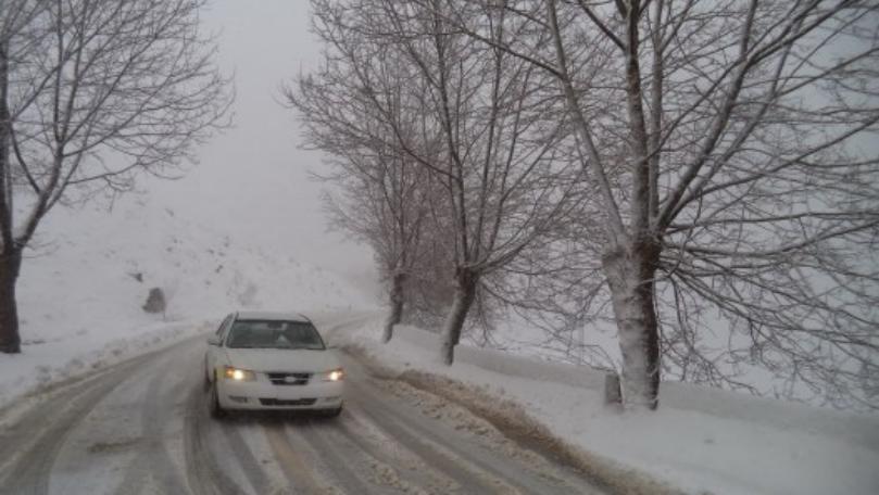
Partly cloudy with a limited rise in temperature and active winds. Starting in the afternoon, the weather turns cloudy with fog on the highlands, and the atmosphere at night becomes ready for scattered rain, increasing in intensity at dawn on Thursday, with lightning, thunder, and an increase in wind speed to exceed 90 km/h in the north, with a warning of sea waves rising up to 3 metres, and snow falling at an altitude of 1,500 metres.
Thursday:
Generally cloudy with fog on the highlands and a noticeable drop in temperatures. Scattered and heavy rains fall with lightning, thunder, and active winds approaching 75 km/h. Sea waves rise to 3 metres. Snow also falls at an altitude of 1,500 metres, during the day and gradually declines to reach 900 meters at dawn on Friday in the northern highlands and in the interior areas.
Friday:
Cloudy with fog in the highlands and a further drop in temperatures. Scattered rain falls with lightning and thunder, especially in the northern regions. Snow falls at an altitude of 900 meters on the northern highlands and inland. The weather gradually improves as of noon and turns partly cloudy in the afternoon with a warning of ice formation at an altitude of 1000 metres.
The temperature on the coast is from 14 to 20 degrees, above the mountains from 4 to 10 degrees, and in the interior from 6 to 13 degrees.
Surface winds: southwesterly during the day, with speeds between 10 and 35 km/h.
Visibility: Good on the coast, worse on the highlands due to fog.
-Relative humidity on the coast: between 50 and 75%.
Sea condition: low wave height, water surface temperature: 18 degrees.
-Atmospheric pressure: 764 mm Hg.
-Sunrise hour: 6.13
-Sunset hour: 17.31
The post The storm is coming… and this is what the coming days will witness appeared first on 961today Lebanon Today.